14 Aug
Nowadays, digital technology can improve user experience across a variety of segments. One of them is travel, more specifically hiking and travel maps. Although you can find maps on the internet, paper maps still retain a certain charm. After all, a smartphone has limited battery capacity and can fail you in challenging conditions. It’s much easier to lay out a whole hiking map in front of you.
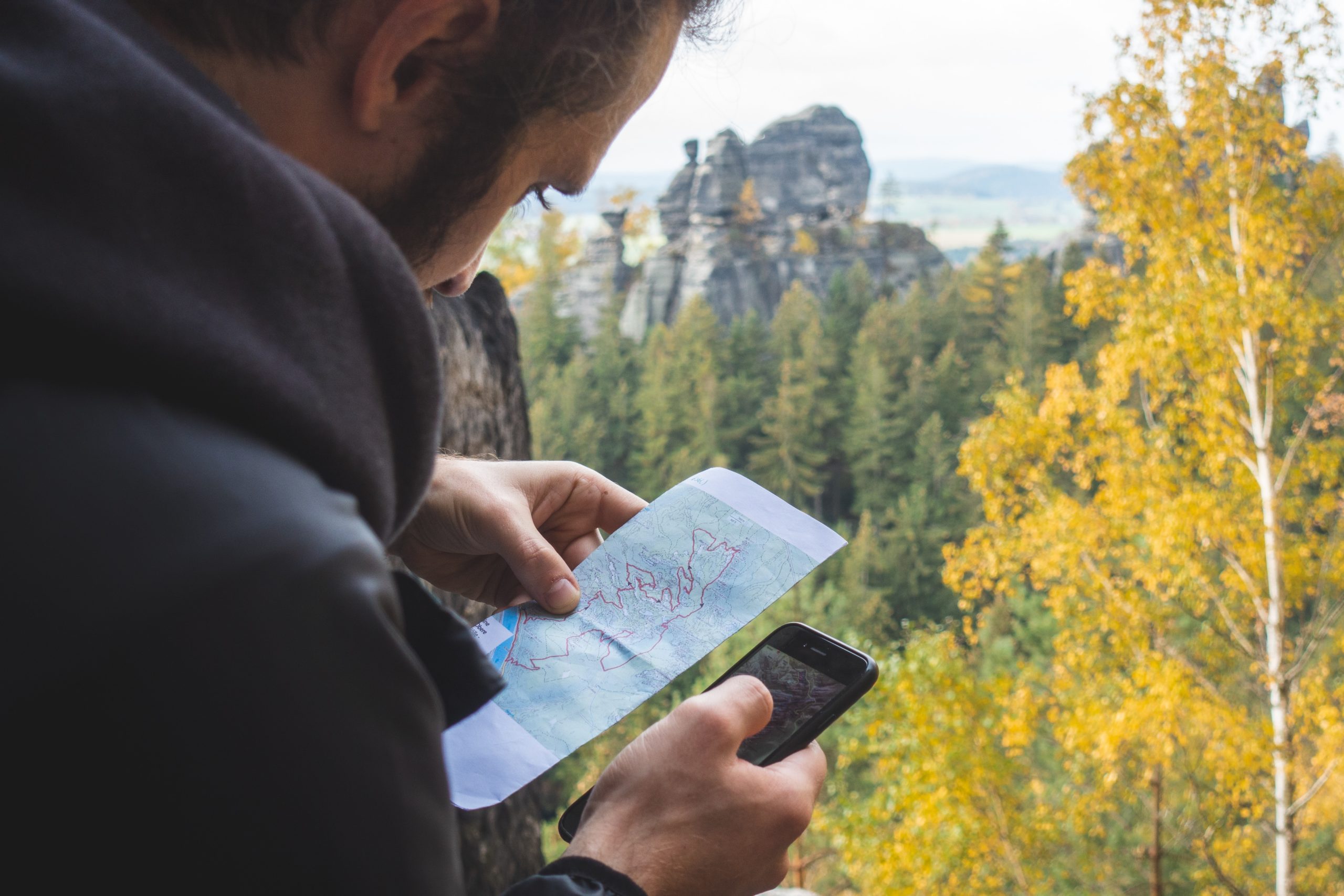
But how can you find interesting places or attractions to visit along the way on your favourite printed map? That’s what we’ve managed to bring to life with the development of Map Explorer. With a simple scan of the paper map via your smartphone, all the interesting spots, tours, attractions, landmarks, museums, shelters and much more will appear on your display in real time. You can also click on these places, see their photographs and descriptions, or go straight to the website to find out more information.
Services: Technical Prototyping, Implementation, iOS & Android App Development, Consultancy
Industry: Travel & Tourism
Location: Slovakia
Business Context
Creative Business Studio is committed to creating products that have a clear mission – to show a unique view of the landscape. At the same time, it’s designed to make the whole process easier for the user, whether it’s through painted maps, photos of regions, updated tourist maps or virtual tourist 360 photos.
The idea to create Map Explorer was a natural outcome of the needs of tourists, who needed to simplify their route planning and at the same time get all the necessary information about nearby attractions in one place, without having to spend a lot of time searching for this information. Map Explorer brought innovation to a segment where there seemed to be no scope for further improvement.
We helped our partner, CBS, create a unique app that is unparalleled and will not only help tourists utilise their time but will also help them discover new places of interest just by hovering their smartphone over any tourist map. In doing so, CBS has further reinforced its position and strengthened its mission to provide a unique view of the landscape.
Key challenges
In developing the Map Explorer project, we had to overcome several challenges:
- In the first phase of prototyping, we first had to verify whether it was even possible to enhance the map with digital points of interest in real time without augmenting the map with printed markers.
- From a project management point of view, the biggest challenge was to manage a project where it was not clear from the beginning whether the technical solution would be feasible and sufficient for the business requirementst.
- A significant challenge was to create a technological solution for the recognition of the part of the map being scanned.
- In addition to recognition, mapping digital points of interest was also a challenge. The accuracy of recognition, the speed on mobile devices, dealing with different lighting constraints and the variety of mobile devices and their cameras were all points to consider.
Despite these challenges, we were able to create a unique and precedent-setting solution that will make it easier for tourists to plan experiences while meeting the business requirements of our client, CBS.
Process
As Map Explorer was an innovative project, in the first phase we focused on technical prototyping. We took on all the costs until we were certain that the technology would work 100% of the time.
Interestingly, the project was originally meant to be financed by European funds. The approval process took a long time, but in the end it could not be brought to a successful conclusion. However, this gave us time to explore all the technological possibilities and subsequently prepare a prototype.
Technology used:
- React Native
- React
- NodeJS
- AWS
- DynamoDB
Our partner, CBS, was so happy with the prototype that we were able to start working on the final solution, which we translated into an Android and iOS app. Using an open-source library of computer vision algorithms, OpenCV, we enhanced printed maps with augmented reality, which allowed us to differentiate printed maps and associate individual points of interest with them. To give you a better sense of what it does, if you want to know if a particular lodge in the High Tatras is open, or if they have any vacancies or special offers, all you have to do is open the link that appears on the map and read the relevant information.
Another solution used in the development process was React Native with a proprietary Android and iOS module, as well as React, NodeJS, AWS and DynamoDB for creating maps. The entire solution was fine-tuned through multiple iterations to make map detection work not only from multiple angles, but also in low-light environments.
INTERESTED? BOOK A FREE CONSULTATION!
Result
The right choice of technology used and a well thought-out process involving technical prototyping ensured that the app works on a wide range of Android and iOS devices, without significant errors even in difficult lighting conditions. We have managed to create a technology that scans the map in real time, detects individual points of interest and associates them with information about the point of interest in real time. At the same time, we learned a valuable lesson in project management, where we confirmed the agility of our team, which we will be able to make full use of in future projects.
The aim of the project – to transform traditional printed maps into an interactive display and to complement them with detection and subsequent augmentation with real-time digital waypoints – was achieved in line with our expectations. In addition, the Map Explorer project has become the basis for future projects using artificial intelligence.
Map Explorer is currently available for download via Google Play and the App Store, and it also works in offline mode. That’s sure to be appreciated by any hiker who doesn’t necessarily always have access to the internet on their adventures. After simply scanning the ISBN code of a printed map, you will be presented with the option to view that map. Moving the camera around the map will show its various points, including the name of each given location. Clicking on it will bring up a description of the place and any relevant information about it.
Innovation in the travel & tourism industry
Tourism and travel has taken a major leap forward in recent years thanks to innovative technology, whether it’s voice search, virtual reality, chatbots or augmented reality. It is the latter – augmented reality – that we used in the Map Explorer project to make the whole process of planning tourism and travel easier and more enjoyable for users.
Thanks to the app, users can customise their itinerary in even more detail and visit many more places of interest without spending too much time planning. All they need is a map and an app to enhance their hiking experience.
The benefits of Map Explorer
- Ease of use by scanning the map ISBN code
- Saving time when planning tourist and travel experiences
- Simplified searching for attractions, trips and interesting routes across the map area
- Information about attractions, excursions and points of interest, all in one place
Map Explorer features
- Scannable ISBN code for all available hiking maps
- Real-time map detection
- Easy scanning of the printed map using the phone’s camera
- Interactive display of points of interest on the map using augmented reality
- Grouping and filtering points of interest by category
- Creation of maps by an administrator
- Also works offline without internet access
The project involved a team of experts
Ján – Account manager
Jozef – Junior developer with AI skills who designed the prototype algorithm
Martin – Senior developer and AI expert who perfected the algorithm alongside Jozef
Michal – contributed to the development of the React Native application itself
Michal – Project Manager
Developing Map Explorer through the eyes of our experts
What did the beginning of the collaboration look like?
As Map Explorer was a very innovative project, the first phase involved prototyping to determine whether it was technologically feasible to enrich the map with digital points of interest in real time. Originally the project was to be funded by European funds, but after several delays the money could not be obtained. We used this time to explore the technological possibilities and showed the customer a working prototype.
What were the biggest challenges you encountered?
The biggest challenge was recognising the scanned part of the map and mapping the digital points of interest based on the map template created by the administrator. The accuracy of the recognition, the speed on mobile devices, different lighting constraints and the differentiation of mobile devices and their built-in cameras made development difficult for us. Eventually, we were able to overcome these issues through multiple iterations of prototypes. At the same time, technical prototyping was also a challenge for project management and a great exercise in how to lead a project where it is not possible to determine in advance whether the technical solution will be sufficient for the business requirements.
What lessons can be learnt from the project?
This project has become the basis for our future AI projects.